Welcome back to Map work to explore Continents, Countries and Capital Cities and Physical features.
Learning Objectives:
1. Students name and locate the world’s continents and oceans
2. Students identify specific continents, countries, capital cities and physical features of chosen countries.
The Earth
•The Earth is mostly water
•¾ of the Earth is covered in water
•The big bodies of water on Earth are
called oceans
•The big pieces of land on Earth are
called continents
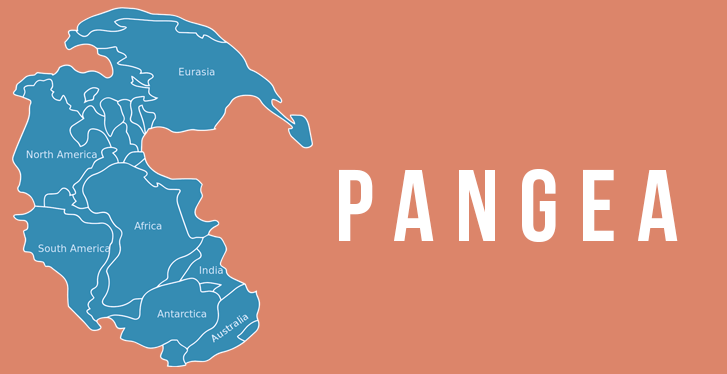
. The Earth once had one continent called Pangea. which was a supercontinent.
. Pangea began to break up about 200 million years ago as a result of the movement of the Earth's tectonic plates and mantle convection.
. Pangaea started to break up into two smaller supercontinents, called Laurasia and Gondwanaland.
Task 1.
World Map Jigsaw
Student Instructions:
1.
Use the jigsaw puzzles of world map
2.
Rearrange
the shapes so they look like the world map
3.
Write the names
of each continent on the map
4.
Add any
other mapping features you think are missing
5.
Name as
many seas as you can
6.
Locate and
name as many countries as you can
7.
Locate and
name as many capital cities as you can
More facts about Continents click on the link below;
https://www.kids-world-travel-guide.com/continent-facts.html
More facts about Continents click on the link below;
https://www.kids-world-travel-guide.com/continent-facts.html

No comments:
Post a Comment